
ファイル:Paris europe train map.png
このプレビューのサイズ: 552 × 600 ピクセル。 その他の解像度: 221 × 240 ピクセル | 442 × 480 ピクセル | 707 × 768 ピクセル | 1,024 × 1,113 ピクセル。
元のファイル (1,024 × 1,113 ピクセル、ファイルサイズ: 62キロバイト、MIME タイプ: image/png)
ウィキメディア・コモンズのファイルページにある説明を、以下に表示します。
|
| 解説 |
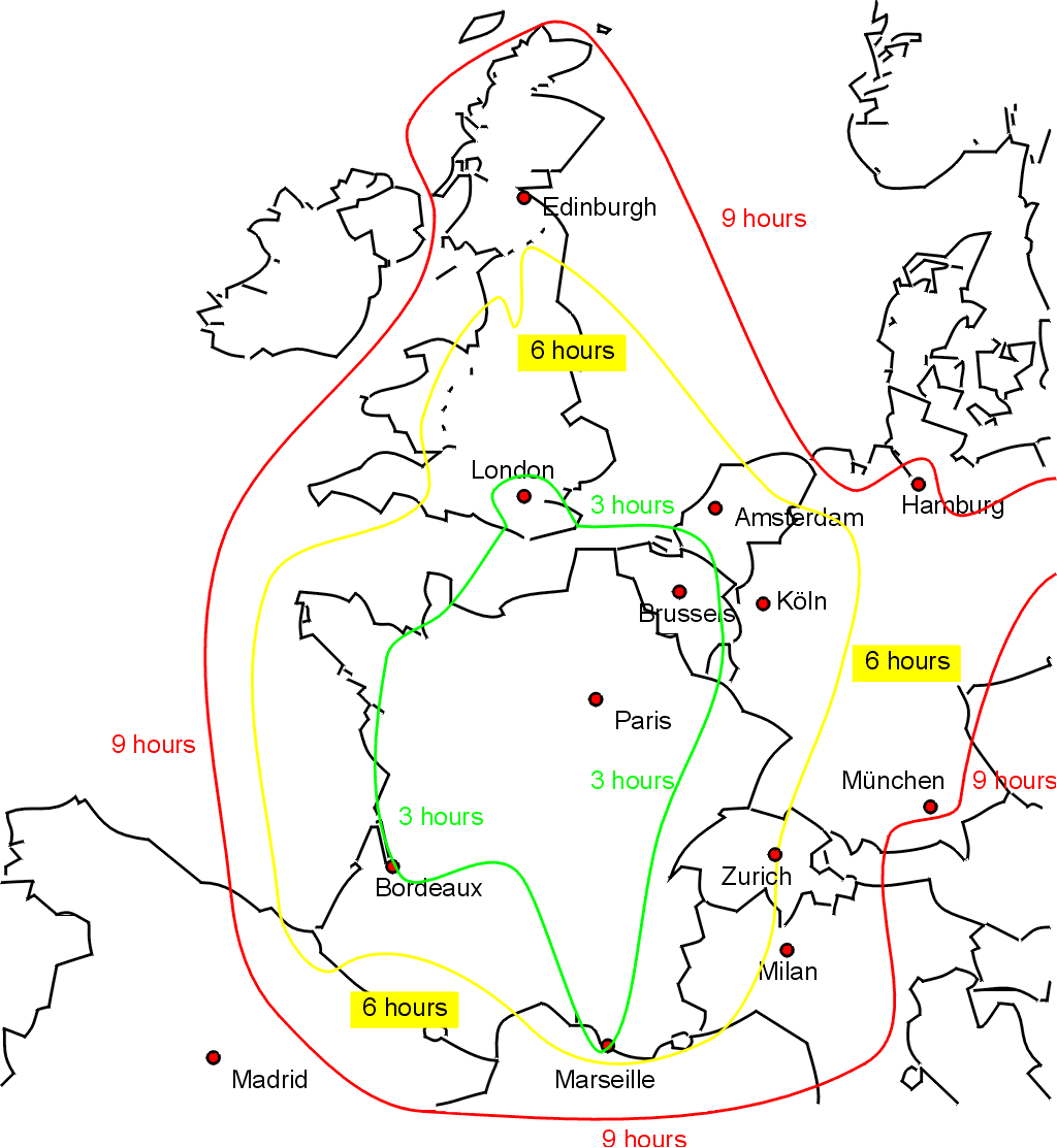
English: Sketch map showing approximate journey times on the train from Paris to the rest of western Europe. Drawn by Bob Tubbs, based on queries to the SNCF website. |
||
| 日付 | 2005年5月31日 (当初のアップロード日) | ||
| 原典 | 投稿者自身による著作物 | ||
| 作者 | User:Rnt20 | ||
| 許可 (ファイルの再利用) |
|
||
| その他のバージョン |
このファイルの派生的著作物: |

|
このtransport map画像は、ベクターイメージである SVG ファイルとして再作成されるべきです。これにはいくつかの利点があります。詳しくはCommons:Media for cleanupを参照してください。この画像の SVG 形式がすでに利用可能である場合は、アップロードしてください。アップロード後、この画像にあるこのテンプレートを{{Vector version available|新しい画像ファイル名.svg}}テンプレートで置き換えてください。
|
ファイルの履歴
過去の版のファイルを表示するには、その版の日時をクリックしてください。
| 日付と時刻 | サムネイル | 寸法 | 利用者 | コメント | |
|---|---|---|---|---|---|
| 現在の版 | 2005年5月31日 (火) 19:36 | | 1,024 × 1,113 (62キロバイト) | Rnt20 | Sketch map showing approximate journey times on the train from Paris to the rest of western Europe. Drawn by Bob Tubbs, based on queries to the SNCF website. A French version can be seen at Image:paris_europe_train_map_fr.png {{PD-self}} |
ファイルの使用状況
このファイルを使用しているページはありません。
グローバルなファイル使用状況
以下に挙げる他のウィキがこの画像を使っています:
- cs.wikipedia.org での使用状況
- en.wikipedia.org での使用状況
- en.wikinews.org での使用状況
- en.wikivoyage.org での使用状況
- fa.wikivoyage.org での使用状況
- he.wikivoyage.org での使用状況
- incubator.wikimedia.org での使用状況
- zh.wikipedia.org での使用状況
- zh.wikivoyage.org での使用状況