
ファイル:Peloponnesos Map.png
元のファイル (808 × 852 ピクセル、ファイルサイズ: 234キロバイト、MIME タイプ: image/png)
ウィキメディア・コモンズのファイルページにある説明を、以下に表示します。
|
| 解説 |
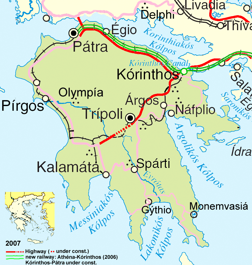
Deutsch: Wichtigste Verkehrsachsen des Peloponnes, Stand 2007.
English: Main traffic lines in the Peloponnese, as of 2007. |
| 日付 | |
| 原典 | see author |
| 作者 | ulrichstill |
| その他のバージョン | Adapted from http://www.un.org/Depts/Cartographic/map/profile/greece.pdf |
- あなたは以下の条件に従う場合に限り、自由に
- 共有 – 本作品を複製、頒布、展示、実演できます。
- 再構成 – 二次的著作物を作成できます。
- あなたの従うべき条件は以下の通りです。
- 表示 – あなたは適切なクレジットを表示し、ライセンスへのリンクを提供し、変更があったらその旨を示さなければなりません。これらは合理的であればどのような方法で行っても構いませんが、許諾者があなたやあなたの利用行為を支持していると示唆するような方法は除きます。
- 継承 – もしあなたがこの作品をリミックスしたり、改変したり、加工した場合には、あなたはあなたの貢献部分を元の作品とこれと同一または互換性があるライセンスの下に頒布しなければなりません。

| This image is a map derived from a United Nations map.
Unless stated otherwise, UN maps are to be considered in the public domain. This applies worldwide. UN maps are, in principle, open source material and you can use them in your work or for making your own map. UN requests however that you delete the UN name, logo and reference number upon any modification to the map. Content of your map will be your responsibility. You can state in your publication, if you wish, something like: based on UN map … (map name, map number, revision number and date). See: Geospatial Information Section. And: Geospatial, location data for a better world. |
 |
ファイルの履歴
過去の版のファイルを表示するには、その版の日時をクリックしてください。
| 日付と時刻 | サムネイル | 寸法 | 利用者 | コメント | |
|---|---|---|---|---|---|
| 現在の版 | 2008年1月16日 (水) 17:54 | | 808 × 852 (234キロバイト) | Ulrichstill | {{Information| |Description= {{de|Wichtigste Verkehrsachsen des Peloponnes, Stand 2007.}} {{en|Main traffic lines in the Peloponnese, as of 2007.}} |Source= see author |Date=01.01.2008 |Author = [[:de:Benutzer:ulrich |
ファイルの使用状況
以下のページがこのファイルを使用しています:
グローバルなファイル使用状況
以下に挙げる他のウィキがこの画像を使っています:
- als.wikipedia.org での使用状況
- bg.wikipedia.org での使用状況
- cy.wikipedia.org での使用状況
- da.wikipedia.org での使用状況
- de.wikipedia.org での使用状況
- en.wikipedia.org での使用状況
- et.wikipedia.org での使用状況
- fr.wikipedia.org での使用状況
- hr.wikipedia.org での使用状況
- hyw.wikipedia.org での使用状況
- id.wikipedia.org での使用状況
- la.wikipedia.org での使用状況
- lt.wikipedia.org での使用状況
- mk.wikipedia.org での使用状況
- ms.wikipedia.org での使用状況
- nds.wikipedia.org での使用状況
- oc.wikipedia.org での使用状況
- pnb.wikipedia.org での使用状況
- th.wikipedia.org での使用状況
- ur.wikipedia.org での使用状況
- vi.wikipedia.org での使用状況
- zh-min-nan.wikipedia.org での使用状況