
ファイル:Txu-oclc-6557994-index-457.jpg

このプレビューのサイズ: 791 × 599 ピクセル。 その他の解像度: 317 × 240 ピクセル | 634 × 480 ピクセル | 1,014 × 768 ピクセル | 1,280 × 970 ピクセル | 2,560 × 1,939 ピクセル | 5,000 × 3,788 ピクセル。
元のファイル (5,000 × 3,788 ピクセル、ファイルサイズ: 4.1メガバイト、MIME タイプ: image/jpeg)
ウィキメディア・コモンズのファイルページにある説明を、以下に表示します。
|
概要
| 解説 |
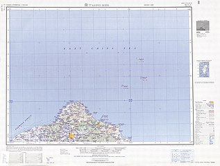
English: Map of the Taipei (T’ai-pei Shih, Taihoku) area of Taiwan, from the Tawian AMS Topographic Maps series |
| 日付 | |
| 原典 | Courtesy of the University of Texas Libraries, The University of Texas at Austin. ([1]) |
| 作者 | Army Map Service (AM), Corps of Engineers, 1950 |
| その他のバージョン |
|

-
 Index Map

![[1]](http://legacy.lib.utexas.edu/maps/ams/taiwan/txu-oclc-6557994-ng51-10-450.jpg)
ライセンス
This image or file is a work of a U.S. Army Corps of Engineers soldier or employee, taken or made as part of that person's official duties. As a work of the U.S. federal government, the image is in the public domain.
|
ファイルの履歴
過去の版のファイルを表示するには、その版の日時をクリックしてください。
| 日付と時刻 | サムネイル | 寸法 | 利用者 | コメント | |
|---|---|---|---|---|---|
| 現在の版 | 2019年9月13日 (金) 07:18 | | 5,000 × 3,788 (4.1メガバイト) | Geographyinitiative | User created page with UploadWizard |
ファイルの使用状況
以下のページがこのファイルを使用しています:
グローバルなファイル使用状況
以下に挙げる他のウィキがこの画像を使っています:
- de.wikipedia.org での使用状況
- en.wikipedia.org での使用状況
- Keelung
- Songshan District, Taipei
- Shilin District
- Sanchong District
- Shenkeng District
- Gongliao District
- Ruifang District
- Shuangxi District
- Shimen District
- Bali District
- Keelung Islet
- Tamsui District
- Xizhi District
- Banqiao District
- Xinzhuang District
- Pengjia Islet
- Zhongzheng District, Keelung
- Qidu District
- Zhongshan District, Keelung
- Anle District
- Nuannuan District
- Cape Fugui
- Mianhua Islet
- Huaping Islet
- en.wiktionary.org での使用状況
- es.wikipedia.org での使用状況
- hy.wikipedia.org での使用状況
- it.wikipedia.org での使用状況
- th.wikipedia.org での使用状況
- zh.wikipedia.org での使用状況