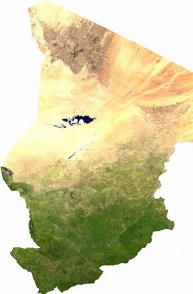
ファイル:Chad sat.jpg

このプレビューのサイズ: 394 × 599 ピクセル。 その他の解像度: 158 × 240 ピクセル | 316 × 480 ピクセル | 505 × 768 ピクセル | 1,265 × 1,922 ピクセル。
元のファイル (1,265 × 1,922 ピクセル、ファイルサイズ: 1.79メガバイト、MIME タイプ: image/jpeg)
ファイルの履歴
過去の版のファイルを表示するには、その版の日時をクリックしてください。
| 日付と時刻 | サムネイル | 寸法 | 利用者 | コメント | |
|---|---|---|---|---|---|
| 現在の版 | 2006年7月13日 (木) 03:43 |  | 1,265 × 1,922 (1.79メガバイト) | Unquietwiki | ECW to TIFF to JPEG (100% quality; progressive formatting). {{PD-MapLibrary}} |
ファイルの使用状況
以下のページがこのファイルを使用しています:
グローバルなファイル使用状況
以下に挙げる他のウィキがこの画像を使っています:
- af.wikipedia.org での使用状況
- als.wikipedia.org での使用状況
- ar.wikipedia.org での使用状況
- bg.wikipedia.org での使用状況
- bs.wikipedia.org での使用状況
- ca.wikipedia.org での使用状況
- da.wikipedia.org での使用状況
- Tchad
- Tchads historie
- Wikipedia:Dagens skandinaviske artikel/september 2009
- Wikipedia:Dagens skandinaviske artikel/Svensk/Uge 36, 2009
- Wikipedia:Dagens skandinaviske artikel/august 2012
- Wikipedia:Dagens skandinaviske artikel/Bokmål/Uge 32, 2012
- Wikipedia:Dagens skandinaviske artikel/maj 2014
- Wikipedia:Dagens skandinaviske artikel/Søndag/Uge 20, 2014
- de.wikipedia.org での使用状況
- de.wikiversity.org での使用状況
- el.wikipedia.org での使用状況
- en.wikipedia.org での使用状況
- eo.wikipedia.org での使用状況
- es.wikipedia.org での使用状況
- eu.wikipedia.org での使用状況
- fa.wikipedia.org での使用状況
- fr.wikipedia.org での使用状況
- hu.wikipedia.org での使用状況
- ig.wikipedia.org での使用状況
- is.wikipedia.org での使用状況
- it.wikipedia.org での使用状況
- ka.wikipedia.org での使用状況
- kk.wikipedia.org での使用状況
- li.wikipedia.org での使用状況
- mn.wikipedia.org での使用状況
- mt.wikipedia.org での使用状況
- nn.wikipedia.org での使用状況
- no.wikipedia.org での使用状況
このファイルのグローバル使用状況を表示する。

