
ファイル:Seale A New and Correct Map of the Coast of Africa, from Cape Blanco, to the Coast of Angola 1750 UTA (A Map of the Gold Coast on a larger Scale).jpg

このプレビューのサイズ: 800 × 428 ピクセル。 その他の解像度: 320 × 171 ピクセル | 640 × 342 ピクセル | 1,024 × 548 ピクセル | 1,280 × 685 ピクセル | 2,416 × 1,292 ピクセル。
元のファイル (2,416 × 1,292 ピクセル、ファイルサイズ: 1.35メガバイト、MIME タイプ: image/jpeg)
ウィキメディア・コモンズのファイルページにある説明を、以下に表示します。
|
概要
| 題名 |
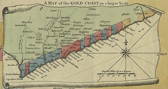
English: A Map of the Gold Coast on a larger Scale から English: A New & Correct Map of the Coast of Africa, from Cape Blanco, to the Coast of Angola: Exhibiting all the European Forts and Settlements |
||||||||||||||||||||||||||
| 日付 | |||||||||||||||||||||||||||
| 原典 | UTA Libraries Cartographic Connections: 地図 / テキスト | ||||||||||||||||||||||||||
| 作者 | |||||||||||||||||||||||||||
| 受入/取得方法 |
English: UTA Libraries Special Collections, Gift of Dr. Jack Franke |
||||||||||||||||||||||||||
| Geotemporal data | |||||||||||||||||||||||||||
| Map location | 西アフリカ | ||||||||||||||||||||||||||
| Georeferencing | If inappropriate please set warp_status = skip to hide. | ||||||||||||||||||||||||||
| Bibliographic data | |||||||||||||||||||||||||||
| 出版物 |
Universal Magazine |
||||||||||||||||||||||||||
| 作者 |
edited by J. Hinton |
||||||||||||||||||||||||||
| 出版地 | ロンドン | ||||||||||||||||||||||||||
| Archival data | |||||||||||||||||||||||||||
| コレクション |
|
||||||||||||||||||||||||||
| 技法 | 彩色された エングレービング / 紙 | ||||||||||||||||||||||||||
| その他のバージョン | |||||||||||||||||||||||||||

.jpg?uselang=ja)
.jpg?uselang=ja)
.jpg?uselang=ja&action=history)
.jpg)
ライセンス

|
This file was provided to Wikimedia Commons by the University of Texas at Arlington Libraries as part of a cooperation project. The University of Texas at Arlington Libraries is part of the University of Texas at Arlington, a public research university located in Arlington, Texas.
|
|
著作者が1785年に死亡しているため、この著作物は、著作権の保護期間が著作者の死後100年以下である国・地域においてパブリックドメインの状態にあります。 この著作物は1929年1月1日以前に公表され、又はアメリカ合衆国著作権局に登録されたため、アメリカ合衆国においてパブリックドメインの状態にあります。 | |
| このファイルは著作権法の既知の制約(隣接権や関連する権利を含む)から自由であると特定されています。 | |
ファイルの履歴
過去の版のファイルを表示するには、その版の日時をクリックしてください。
| 日付と時刻 | サムネイル | 寸法 | 利用者 | コメント | |
|---|---|---|---|---|---|
| 現在の版 | 2022年1月13日 (木) 20:33 | | 2,416 × 1,292 (1.35メガバイト) | Michael Barera | File:Seale A New and Correct Map of the Coast of Africa, from Cape Blanco, to the Coast of Angola 1750 UTA.jpg cropped 45 % horizontally, 63 % vertically using CropTool with precise mode. |
ファイルの使用状況
以下のページがこのファイルを使用しています:
グローバルなファイル使用状況
以下に挙げる他のウィキがこの画像を使っています:
- de.wikipedia.org での使用状況
- en.wikipedia.org での使用状況
- es.wikipedia.org での使用状況
- hu.wikipedia.org での使用状況
- ru.wikipedia.org での使用状況
- simple.wikipedia.org での使用状況
- zh.wikipedia.org での使用状況
.jpg)